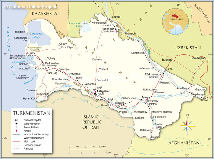
Turkmenistan
was once part of the ancient Persian Empire. The Turkmen people were originally pastoral nomads and some of them continued this way of life up into the 20th century, living in transportable dome-shaped felt tents. The territory was ruled by the Seljuk Turks in the 11th century. The Mongols of Ghenghis Khan conquered the land in the 13th century; they dominated the area for the next two centuries until they were deposed in the late 15th century by invading Uzbeks. Prior to the 19th century, Turkmenia was divided into two lands, one belonging to the khanate of Khiva and the other belonging to the khanate of Bukhara. In 1868, the khanate of Khiva was made part of the Russian Empire and Turkmenia became known as the Transcaspia Region of Russian Turkistan. Turkmenistan was later formed out of the Turkistan Autonomous Soviet Socialist Republic, founded in 1922, and was made an independent Soviet Socialist Republic on May 13, 1925. It was the poorest of the Soviet republics.
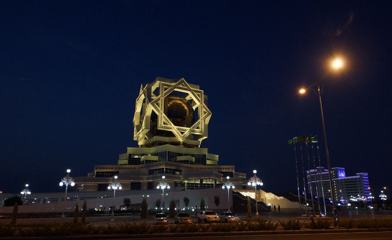
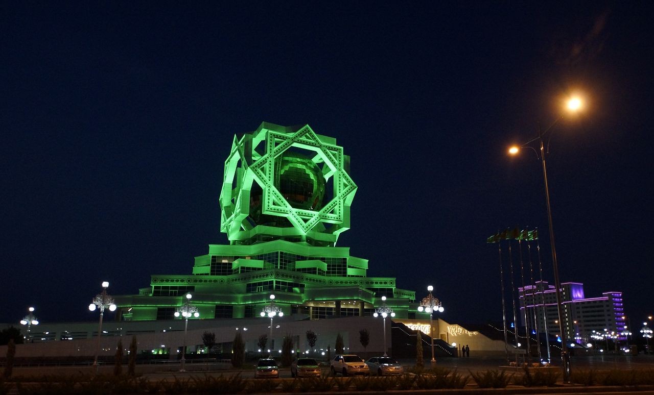
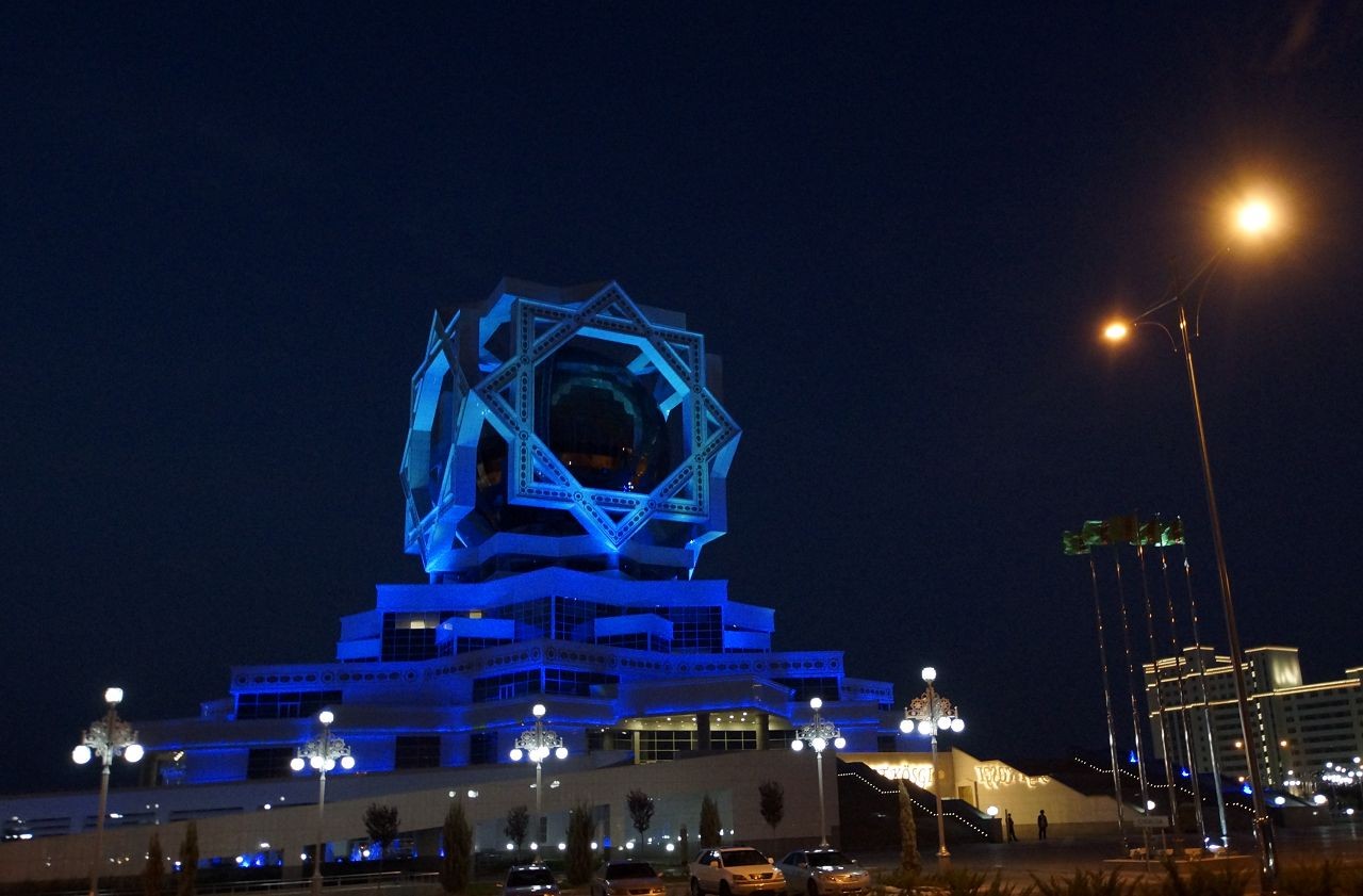
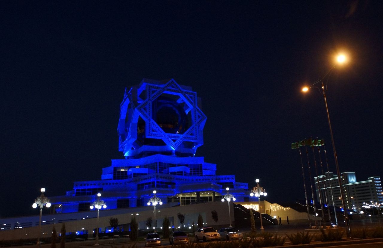
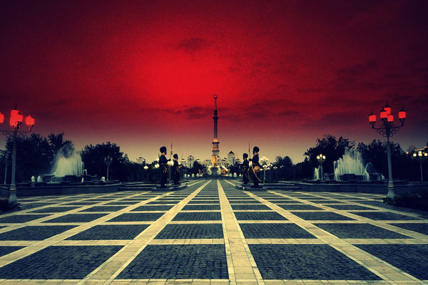
Ashgabat
welcome to the marble city

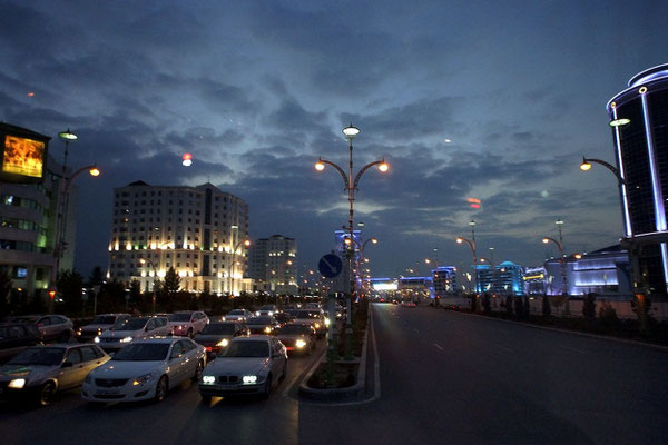
Ashgabat (‘the city of love’ in Arabic) has reinvented itself as a showcase city for the newly independent republic and is definitely one of Central Asia's – if not the world's – strangest places. Built almost entirely off the receipts of Turkmenistan’s oil and gas revenues, the city’s transformation continues at break-neck speed, with whole neighbourhoods facing the wrecking ball in the name of progress, and gleaming white marble monoliths springing up overnight like mushrooms. Its modern incarnation is somewhere like Las Vegas !
It’s a surprisingly relaxed city, with a varied dining scene, making it a pleasant place to spend a few days absorbing Turkmenistan’s bizarre present before heading into the rest of the country to discover its fascinating past.


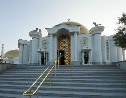
Kipchak Mosque and Mausoleum of Turkmenbashi

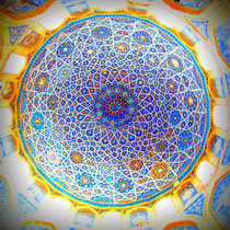
A few kilometers outside of Turkmenistan’s capital Ashgabat stands the largest mosque in Central Asia. Adorned with an immense golden cupola 50 meters in diameter and 4 tall minarets 91 meters high, it certainly delivers a visual impact.
Inside, interlocking 8-sided stars from cherry wood and pillars cased in Carrara marble set the stage for a huge handwoven carpet in the center of the mosque. 10 000 worshipers can attend services inside the mosque, but it usually sits empty.


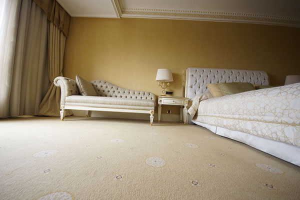
Hotel Nusay
Following a very fancy transformation, the Nusay is now Ashgabat's best-value luxury option.
It's perfectly located between the new and old city, and overlooks the presidential palace.
Rooms are spacious, comfortable and luxuriously appointed.


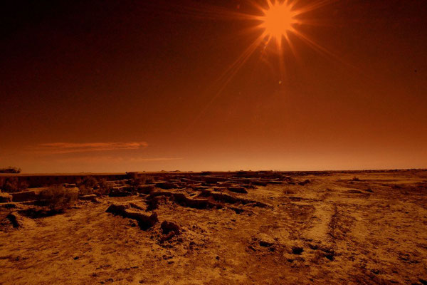
Across the Karakum Desert

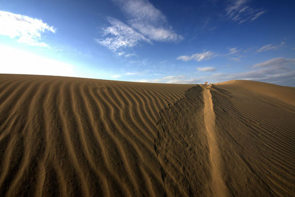
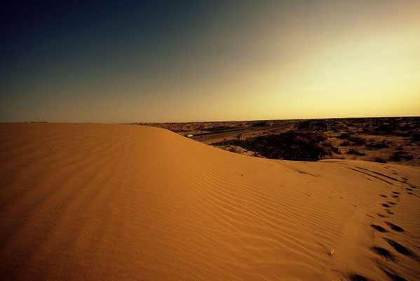

Surrounded by the Karakum desert in Turkmenistan feeds the river Murghab a large oasis. In it grew from the 6th century BC. a metropolis zoom, the hundreds of thousands of residents counted in the Middle Ages:
M E R V
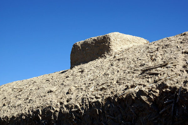
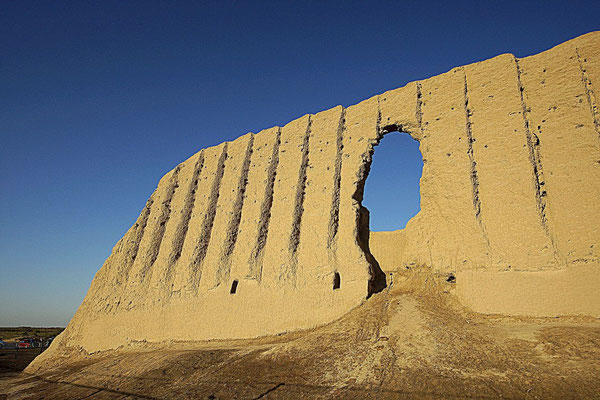
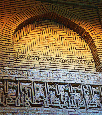
Legendary rich was the oasis city, a major hub on the Silk Road, a spiritual center of the Islamic world. The whole built of clay, Merv reached its heyday in the 11th and 12th centuries as eastern capital of the Seljuk Empire, just before the city went down cruelly.
At the conquest under the Mongols Tolui, son of Genghis Khan, in the middle of February 1221, the thriving metropolis was destroyed and the population almost completely exterminated. According to some historians more than 1 million people were killed during the siege, several hundred thousand of refugees who had fled to the city. Thus the siege is one of the bloodiest conquests of world history.
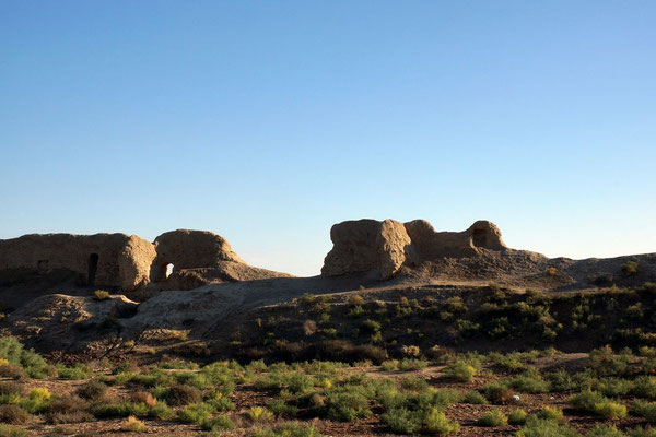
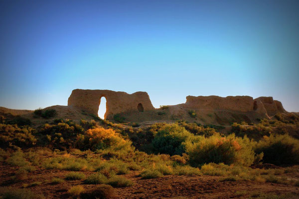
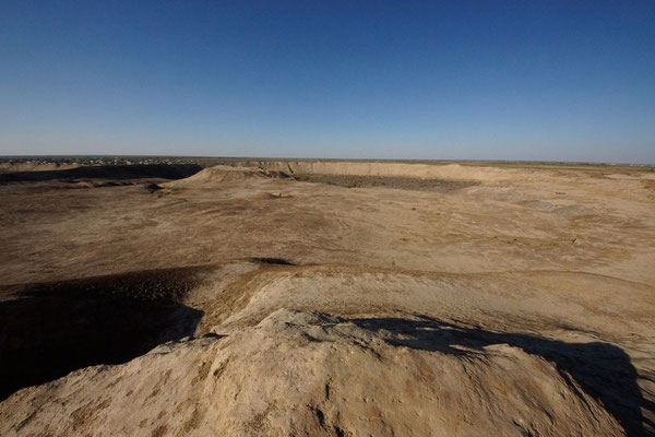
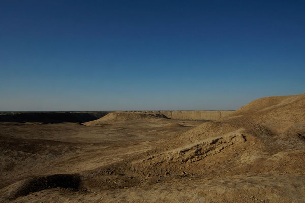
Gonur Depe (ancient state of Margush)


Those travellers who have followed the Silk Road will have become used to restored cities – Bukhara, Samarkand and Khiva in Uzbekistan. And very fine they are too. But if you venture south to Turkmenistan and visit Merv it is a very different sort of experience.
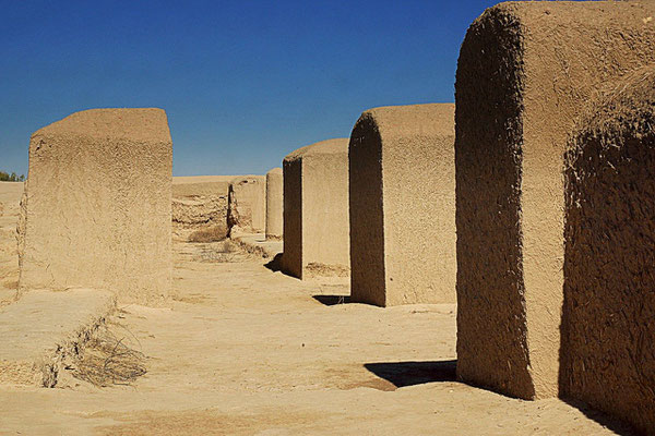
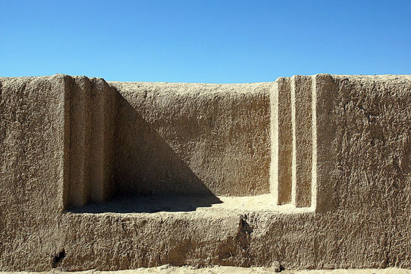
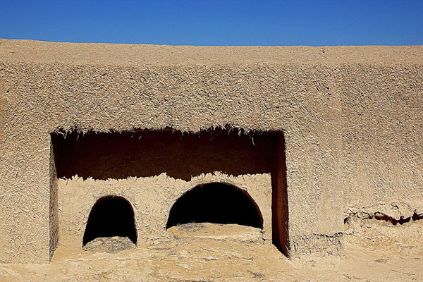
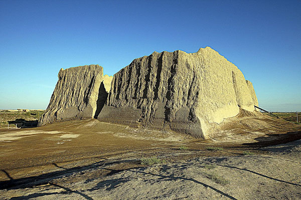
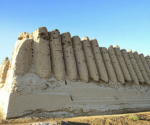
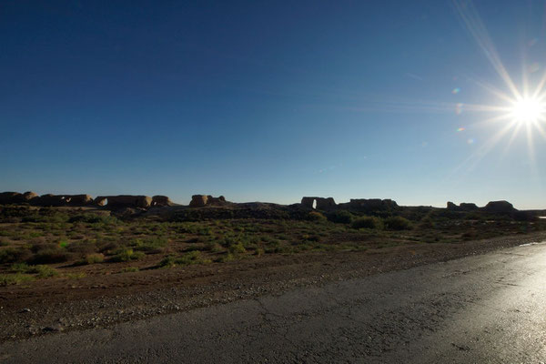
This 120 square kilometre site contains the remains of at least 5 different cities dating from the 6th century BCE through Alexander the Great and the Persians to the Seljuk Turks. At which point it was totally destroyed by Genghiz Khan in 1221. The newer cities were built alongside (rather than “over” which is the norm in most continually inhabited sites) the old and all used mud bricks. So what you see is a jumble of walls, earthworks and misshapen buildings as they succumb to the elements.
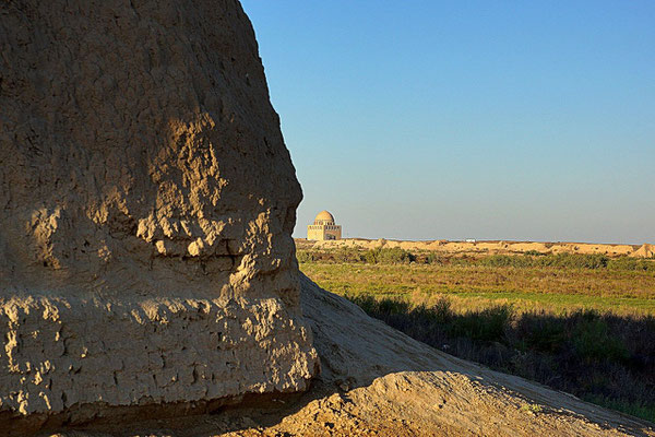
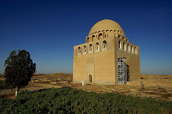
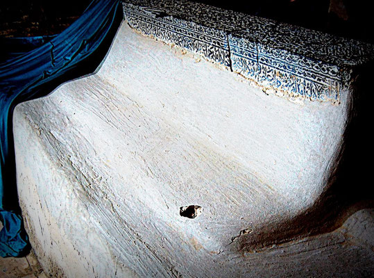
Merv is so large that you will not encounter many other people at most of the spots. Busiest is the mausoleum of Sultan Sanjar, especially popular by local visitors so it seems.
For further informations: ARCHÄOLOGIE-SENSATION (German)
Ancient Merv
The fortress Gyz Kala, the mausoleum of Sultan Sanjar and Mohammed ibn Zayed


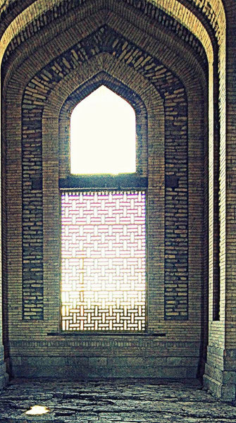
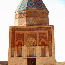
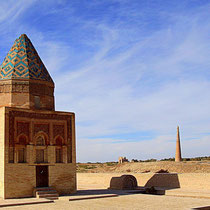
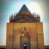
Konye-Urgench
Konye-Urgench is situated in north-western Turkmenistan, on the left bank of the Amu Daria River. Urgench was the capital of the Khorezm region, part of the Achaemenid Empire. The old town contains a series of monuments mainly from the 11th to 16th centuries, including a mosque, the gates of a caravanserai, fortresses, mausoleums and a 60-m high minaret. The monuments testify to outstanding achievements in architecture and craftsmanship whose influence reached Iran and Afghanistan, and later the architecture of the Mogul Empire of 16th-century India.
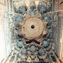
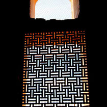
Mausoleum of Turabek-Khanym. The largest building in the plain of Konye-Urgench.
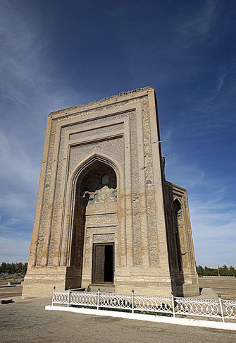

Turabek-Khanym was the daughter of Uzbek Khan who converted the area to Islam. Underside the dome are 365 sections on the mosaic, representing the days of the year. The twenty four arches beneath the dome represent the hours of the day, the twelve larger arches below represent the months of the year and the four massive windows finally represent the weeks within the month. therefore all the geometric patters in the building form a large calendar


Click for a lot of portraits, snapshots
of people I met in Caucasus and on Silk Road
with the kind support of kulturreisen-gordion.de